Skip to content
My spotsMy alertsShop
Live anemometer

Wissant wind forecast: Deux Caps bay, tides, swell and spot guide

Guide reviewed by Greg Nicholls · Founder of GlissEvolution and rider since 1999 · checked on

Reading at 06:56 · 5 min ago
112° ESE
4.1 kn
Minimum
2.8kn
Gust
5.4kn
Eau • live
13°C
Air
3,8°C
Anemometer location Sangatte sailing centre, Opal Coast (~12.5 km north-east of Wissant) Show the map

Wind, wave and tide forecast

The colour codes you already know, plus the tide.

Detailed forecast
DayMon 09/11Tue 10/11Wed 11/11Thu 12/11Fri 13/11Sat 14/11Sun 15/11Mon 16/11Tue 17/11Wed 18/11Thu 19/11Fri 20/11Sat 21/11Sun 22/11Mon 23/11Tue 24/11
Time07h08h09h10h11h12h13h14h15h16h17h18h19h20h21h22h23h00h01h02h03h04h05h06h07h08h09h10h11h12h13h14h15h16h17h18h19h20h21h22h23h00h01h02h03h04h05h06h07h10h13h16h19h22h01h04h07h10h13h16h19h22h01h04h07h10h13h16h19h22h01h04h07h10h13h16h19h22h01h04h07h10h13h16h19h22h01h04h07h13h19h01h07h13h19h01h07h13h19h01h07h13h19h01h07h13h19h01h07h13h19h01h07h13h19h01h07h13h19h01h07h13h19h
Wind (kn)435577776677877778764999791010119778999108566666751516141411131412111213182126232320201916141413878991011121191098101314151720242519182324292824192089162228222533312726342824242332319131312913
Gusts (kn)7688111111111111111313131212121313131217181817161818201917141415161617171410101011111211-----------------------------------------------------------------------------
Direction
Waves (m)0.20.20.20.20.20.20.20.20.20.20.20.30.30.30.30.30.30.30.30.40.40.40.40.40.40.50.50.50.50.50.50.50.50.50.50.50.50.50.50.50.50.50.50.50.50.5-----------------------------------------------------------------------------
Period (s)45555565554444444455555555555555666677889910101010-----------------------------------------------------------------------------
Swell
Temp (°C)44346777777666554433233322233456777777666555541010101010111110910101111111111111111111111119877799765434810121113131315151514141311129987109111313141313131313131212109866678
High cloud (%)4351009910010010010010010010010010010010010010010010010010010010010010010010010010010010010010010010010010095559105531910070898810010010010010010010068100533368863725105256100100339910010010016676828
Mid cloud (%)51111451001001001001001001001001001001001001001001001001001001001001008955100333710068983755310063709450237610016971001005780368385351005
Low cloud (%)94100100100903218465939344576281537292100100100100934791218224024238964911001009710093271001001001001001001001007551001001001001001001001001001001007810080375331005768991001001633237705881001007710071510010097590811004563597137438310010013725
Rain (mm)0.10.20.30.10.30.10.10.10.10.10.30.10.10.60.11.00.50.11.10.71.70.30.90.40.50.60.81.21.60.4
Stars★★★★★★★★★★★★★★★★★★★★★★★★★★★★★★★★★★★★★★★★★★★★★★★★★★★★★★★★★★★★★★★★★★★★★★★★★★★★★★★★★★★★★★★★★★★★★★★★★★★★★★★★★★★★★★★★★★★★★★★★★★★★★★★★★★
Tide

Details: maps, models, tide and webcams

Trend & forecast · AROME Météo-France 1.3 km
Trend · forecast +6 h  ↗ rising over 6 h
PastAhead0246857723405h07h09h11h13h
━ measured reading ━ AROME 1.3 km forecast · compare for yourself

Wind map around Wissant

Hour-by-hour animated forecast · move the map to explore
AROME 1.3 km
Loading the wind map…
- kn
Wissant
Now
035+ kn
GlissEvolution map · official Météo-France data · AROME model
📡 “Base de voile Tom Souville · Sangatte” anemometer ~12.5 km from Wissant · Wind data (c) contributors of the OpenWindMap wind network

Swell heading for Wissant

Press ▶ to watch the swell move over the next 7 days
MFWAM
Loading the swell map…
- m
Wissant
Now
Reading the swell…
Understand the map and the data
Colour = swell size →Arrow = direction it travels Dot = Wissant
Offshore swell size
flat 0.5 m 1 m 2 m 3 m 4 m 5 m 6 m +
Swell height offshore (significant height) and direction of travel. Near the shore the waves are smaller. MFWAM Météo-France + GFS-Wave via Open-Meteo (CC BY 4.0).

Model comparison for Wissant

10 weather models queried side by side for the next 15 days. When they agree, the forecast is solid; when they diverge, the confidence bar turns red. Beyond ~5 days only the global models (GFS, ECMWF) still reach: the grid shrinks and confidence drops.

Best consensus window: Thu 12 12h → 06h (Fri 13), average 18 kn (peak 20 kn), confidence medium.
Model Mon 9 Tue 10 Wed 11 Thu 12 Fri 13 Sat 14 Sun 15 Mon 16 Tue 17 Wed 18 Thu 19 Fri 20 Sat 21 Sun 22 Mon 23 Tue 24
Model 06h 09h 12h 15h 18h 21h 00h 03h 06h 09h 12h 15h 18h 21h 00h 03h 06h 09h 12h 15h 18h 21h 00h 03h 06h 12h 18h 00h 06h 12h 18h 00h 06h 12h 18h 00h 06h 12h 18h 00h 06h 18h 06h 18h 06h 18h 06h 06h 06h 06h 06h 06h
ARPEGE-EU ±2.1 Météo-France · 10 km 4 6 8 9 10 10 11 10 12 14 15 14 13 11 8 8 9 8 7 8 6 5 4 2 3 12 16 19 16 · · · · · · · · · · · · · · · · · · · · · · ·
AROME-HD ±2.3 Météo-France · 1.3 km 2 5 6 6 8 7 6 6 6 11 8 8 13 8 7 7 11 · · · · · · · · · · · · · · · · · · · · · · · · · · · · · · · · · · ·
GFS ±8.0 NOAA · 13 km 4 7 8 9 11 12 12 13 15 16 14 15 13 14 12 14 19 20 17 16 14 10 10 11 16 21 25 20 21 17 15 6 9 11 15 13 12 14 16 18 20 20 19 15 24 20 16 15 28 28 18 28
ICON-D2DWD · 2 km 4 3 6 9 8 9 10 11 13 16 15 11 12 11 3 5 · · · · · · · · · · · · · · · · · · · · · · · · · · · · · · · · · · · ·
Harmonie-NLKNMI · 2 km 4 7 6 8 7 9 10 12 14 16 17 13 12 10 6 6 6 5 12 10 · · · · · · · · · · · · · · · · · · · · · · · · · · · · · · · ·
Harmonie-DMIDMI · 2 km 4 7 7 8 8 9 10 13 13 17 17 15 12 9 5 4 6 6 12 · · · · · · · · · · · · · · · · · · · · · · · · · · · · · · · · ·
Harmonie-EUKNMI · 5,5 km 6 7 7 9 9 10 10 12 13 17 15 13 10 9 7 5 4 5 3 6 · · · · · · · · · · · · · · · · · · · · · · · · · · · · · · · ·
ICON-EUDWD · 7 km 5 5 6 9 9 9 9 11 11 13 12 11 11 9 4 7 8 8 10 10 10 9 8 10 10 13 16 17 14 11 6 3 · · · · · · · · · · · · · · · · · · · ·
ECMWF IFSECMWF · 25 km 4 6 7 9 10 10 10 11 12 13 14 13 12 11 8 7 8 11 14 14 13 12 12 10 9 19 23 20 17 15 12 6 1 4 6 10 10 4 6 6 7 9 10 19 23 20 14 16 20 19 5 ·
ECMWF AIFSECMWF · IA 6 6 6 8 10 11 11 12 14 14 14 14 14 13 11 10 10 10 11 11 11 11 10 11 14 22 21 20 18 13 10 7 6 6 8 11 15 20 23 26 29 32 28 29 20 11 12 18 15 21 23 37
Consensusmodel average 4 6 7 8 9 10 10 11 12 15 14 13 12 10 7 7 9 9 11 11 11 9 9 9 10 17 20 19 17 14 11 5 5 7 9 12 12 13 15 17 19 21 19 21 22 17 14 16 21 23 15 33
Confidenceagreement between models

🎯 Who gets it right here: over 30 days against our anemometer, ARPEGE-EU is off by 2.1 kn on average, against 8.0 kn for GFS (which overestimates by 6.3 kn on average). Scored models are ranked from most to least accurate.

high confidence (spread < 1.5 kn) good medium low (models disagree)
Figures = average wind in knots, 3 h steps for the first 3 days, then 6 h and 12 h. Hover a cell for gusts and direction. A dot (·) marks a model that does not cover this spot.

Tide · Wissant · référence Calais SHOM · astronomical prediction
1.24 m
▲ Rising +0 cm/h
Coeff.
84
Spring tides
Previous tide
LW
06:58 · 1.2 m
Next tide
HW
12:03
SHOM astronomical prediction · “now” in the middle · height / chart datum
Swell readings
CANDHIS buoys · Cerema
Swell forecast
Model, when no buoy is available
Now
0.2m
4s · SW
+3h
0.2m
5s · WSW
+6h
0.2m
6s · WSW
+12h
0.3m
4s · NE
How to read this data?
📍
Active buoys nearby
The CANDHIS buoys used for Wissant are Gravelines. They measure swell height, period and direction to complete the picture of the spot.
🌊
What is H 1/3?
Significant wave height (H 1/3) is the average of the highest third of the waves. It is the value your eye naturally picks up on the water. An H 1/3 of 1.2 m means the biggest waves are around 1.8 to 2 m.
⏱
Why an arrival time?
Swell is not a body of water on the move: it is an energy front travelling in from the open sea. From the period, the direction and the distance between the buoy and Wissant, we estimate the arrival delay shown on each line. It remains an approximation: the coastline and the seabed reshape the swell as it nears the beach.
🏄
What it means for riding
A swell of 0.8 to 1.2 m makes small, fun waves, ideal to start wave riding on a kite, wing or surfboard. The bigger the swell, the bigger the waves: above 1.5 to 2 m it gets serious and is for experienced riders only. The period matters as much as the height: under 7 s the waves are short and hollow, hard to ride. Above 10 s the swell is long, the waves line up well and offer clean faces. The best sessions often combine 1 to 1.5 m with 9 to 12 s.
CANDHIS data · Cerema · French national wave buoy network · Updated every 30 min
Detailed history
Wind trend Last 5 hours
Loading…
Plan your session

Suitable weather windows at Wissant

Based on wind strength and direction only. Then check level, tide, access and local rules in the guide.

How are these windows picked?
We keep the first windows with an average wind between 10 and 31 knots from a direction that suits the spot. Values are averaged over the whole time slot, not taken at a single moment.

Your next 3 windows

Only sessions with enough wind from a suitable direction.

✓ Usable window #1
Friday 13/11 · morning
Fri 13 · 9:00 → 13:00
13kn average ↘
easing from 14 to 12 kn
North · side-onshore ~ on the edge of the rideable range
gusts 21 kn
It works
Gear, reliability and conditions

Gusty: go one size down.

🪁 12 m² kite · 5 m² wing based on 75 kg · wind easing: between two sizes, take the bigger one
Reliability -
Water stateSlight chop
Offshore swell0.7 m · 5 s
Current2.4 kn towards SW
Sky🌤️ Partly cloudy
✓ Usable window #2
Sunday 15/11 · evening
Sun 15 · 18:00 → 21:00
17kn average ↗
rising from 16 to 18 kn
South-southwest · side-offshore ~ on the edge of the rideable range
Good conditions
Gear, reliability and conditions

The window of the day.

🪁 10 m² kite · 4.5 m² wing based on 75 kg · wind rising: between two sizes, take the smaller one
Reliability -
Water stateChoppy
Current1 kn towards WSW
Sky-

Wind against current: short chop

Water 13 °C. Main wind source: AROME Météo-France 1.3 km. Sky, swell and current, when shown: Open-Meteo aggregates on the nearest available grid point. Reliability = spread between the models in the comparison below. Water state estimated from the local wind; swell is the offshore value, taken 2.5 km out (no public model resolves the bay). Open-Meteo data, CC BY 4.0 licence.

Check the AROME forecast for Wissant, the tide with water height, the Channel swell and tips for riding between the Two Caps.

At 06:56, the anemometer reads 4.1 knots from the east-southeast, with gusts of 5.4 knots. The water level observed at Calais is 1.24 m and the tide is rising.

Spot guide

Wissant spot guide

Riding conditions, safety, access and local tips.

⚡ Wissant at a glance
Sports
KitesurfWingfoilWindsurfSurf
Prevailing wind
-
Best period
-
Water • live & tide
~13.0°C
tide: affects launching
Rideable directions: SW · W · NW

📍 Spot location

Close-up aerial view of the Wissant spot
Close-up: the marker shows the launch area.
Wide view of the Wissant spot area
Wide view: where the spot sits geographically.
See on Google Maps ↗

Imagery: aerial photos © IGN / Géoportail (Etalab 2.0 open licence).

Wissant spot

The Wissant spot

The great wind and wave spot of the Côte d’Opale

Wissant is a European benchmark for kitesurfing, windsurfing and wing foiling. The wind accelerates in the strait, but the current, the waves and the beach that disappears at high tide make the spot demanding.

Orientation: SW · W · NW Tide: avoid high water Waves · current · shorebreak Level: intermediate to expert

GlissEvolution practical guide · check conditions and markings on the day of your session.

Conditions

South-westerly to westerly wind

South-westerly is generally side to side-onshore and westerly is more direct. The terrain of the Two Caps can significantly accelerate the wind flow.

A bay that is very sensitive to the tide

At low water, the foreshore is immense. As the tide rises, the current and shorebreak get stronger; at high water, the beach can disappear.

Wave conditions

Depending on the swell, Wissant can change from a choppy riding area to a proper wave spot. Kitesurfing, wing foiling and windsurfing make use of the side-onshore westerly and the prevailing south-westerly wind, the latter requiring a safe margin to get back as it pushes you offshore. Surfing is done with supervision here: the Pays des Deux Caps tourist office lists the École de Surf du Nord in Wissant, known as Shaka Surf School, open from Easter to All Saints' Day. It provides lessons for surfing as well as bodyboarding, stand-up paddleboarding, skimboarding and shore wading from the age of six, in groups of eight at most, with state-certified instructors and sessions timed with the tides. The bay only gets waves with a north-westerly to westerly swell. At high water, the beach disappears in front of the sea wall and the strait's current gets stronger: no rigging or launching. The day's buoyed markers take precedence.

Orientation

The bay's axis runs from Cap Gris-Nez to Cap Blanc-Nez and the sea is to the north-west: shoreline oriented at 322°. North-westerly wind is head-on, westerly is side-onshore and remains the most consistent for riding. South-westerly, though the most frequent, runs along the beach with a component that pushes you offshore: you need a safe margin to get back and suitable gear, it's not a wind that will bring you back on its own. Easterly and south-easterly are offshore winds to be avoided if you're riding independently. The terrain of the two caps significantly accelerates the wind flow and creates local gusts, especially near Gris-Nez.

Safety & rules

No rigging at high water

Don't set up a kite if the beach no longer has a safe area and anticipate the rising water.

Strong current

The strait generates a changing current. Keep a safe margin to get back that is appropriate for your level.

Markers and other users

Respect swimmers, schools and any instructions displayed on the day of your session.

Rules

The permanent beach regulations are set by the permanent municipal order of Wissant no. 2024-AODP-82 of 6 June 2024. Its article 2 creates, opposite Rue Arlette Davids, a 300 m by 300 m supervised swimming zone marked at sea by yellow buoys and on land by two red and yellow bicolour flags, a 300 m by 50 m navigation channel with a five-knot speed limit where 'all other activities are forbidden (swimming, kite surfing, windsurfing, water skiing…)', and two 300 m by 50 m buffer zones on either side of the swimming zone, where 'swimming, navigation and any other activity are strictly forbidden'. Its article 8, dedicated to windsurfing and kitesurfing boards, specifies that 'in the navigation channel, the buffer zones and the swimming zone, the rigging, derigging, launching and landing of kites are forbidden' and that 'in these zones, riding must take place beyond the 300 m coastal strip'; riding is only allowed during the day and within two nautical miles of the shore. You must therefore rig up and launch away from these three zones, by walking there. Article 11 reserves the launching of human-powered craft, including paddleboards and kayaks, to the Gris-Nez side, to the left of the channel. Article 25 states that these provisions only apply when the markers are in place; the temporary order no. 2026-AM-16 of 19 June 2026 sets the supervision period from 1 July to 31 August 2026, from 12pm to 7pm. At sea, there are also the order from the maritime prefect for the Channel and the North Sea no. 41/2018 of 29 May 2018 regulating the practice of nautical leisure and sports, and order no. 93/2022/PREMAR MANCHE/AEM/NP of 21 July 2022 regulating navigation in the 300 m coastal strip of the municipality of Wissant. The local kitesurfing school places the riding zone towards Cap Blanc-Nez, marked by fixed round buoys and flags, and indicates a mandatory third-party liability insurance: these two points are reported by the school and do not appear in the order. The markers and instructions displayed on the day of your session take precedence.

Before you go: check the day’s forecast, tide and swell against what you see on site, and ask for a local briefing if you do not know the spot. Do not go out in offshore or gusty, unstable wind: if in doubt, stay on the beach or pick water where the wind blows you back to shore. Markings, local bylaws, swimming zones and protected areas always take priority over this guide.

Access & facilities

Beach access

Check the tide and the shorebreak from the sea wall before taking your gear down.

Parking

On windy days, use the car parks at the northern entrance to the village and keep emergency access clear.

On-site services

This spot has a live anemometer: the day’s reading always beats the forecast.

Around the spot

Swell buoy used

The CANDHIS campaign at Gravelines is the active directional reference used.

Weather data

Forecast from AROME Météo-France, 1.3 km grid, interpolated to the exact spot coordinates. Long range extended with GFS up to fifteen days. Tide calculated for the reference port of CALAIS. Swell cross-checked against the offshore measuring buoy(s).

Contribute

On-the-ground corrections can be sent through the guide form; they are reviewed before going live.

Recommended gear

Adjust to wind strength, your level and the state of the water
Kitesurf
The right kite, helmet and line cutter
See the kitesurf gear →
Wing foil
Leashes, helmet and impact vest
Wing foil gear →
Surf
Board and leash to suit the swell
Shortboards, mid-lengths and longboards →
Wetsuits
Chosen for the season and session length
The shop’s wetsuit section →

Frequently asked questions

What wind works at Wissant?

South-westerly to westerly winds are the most sought-after. North-westerly is more onshore and easterly is offshore.

What's the best tide at Wissant?

Avoid high water: the beach can disappear in front of the sea wall. Adapt your session time to the swell and the tidal coefficient.

Is Wissant suitable for beginners?

Not for independent riding when there's current, waves or a small beach. It's best to go with a local school.

Is there an anemometer?

No. The table shows the AROME forecast extracted for the specific Wissant grid.

Which swell buoy should I check?

The CANDHIS buoy at Gravelines is the active reference used.

Is kitesurfing regulated at Wissant?

Yes, by the permanent municipal order no. 2024-AODP-82 of 6 June 2024. It creates a 300 m by 300 m supervised swimming zone opposite Rue Arlette Davids, a 300 m by 50 m navigation channel, and two 300 m by 50 m buffer zones on either side. Its article 8 forbids rigging, derigging, launching and landing kites in these three zones, both on the beach and in the water. Riding is only possible beyond the 300 m coastal strip; it is only allowed during the day and within two nautical miles of the shore. You must therefore walk to a free area before rigging up. The local kitesurfing school places this zone towards Cap Blanc-Nez, marked by fixed round buoys and flags, and recommends third-party liability insurance (information reported by the school, not by the order). The lifeguarding dates are set each year: from 1 July to 31 August 2026, from 12pm to 7pm. The order only applies when the markers are in place, which serve as the definitive guide.

Nothing beats seeing it for yourself. Access, bans and riding zones change: always check the actual wind, markings, tide and local instructions before going out.

Summer zoning and insurance requirements cross-checked with the Wissant kitesurfing school; Pas-de-Calais Tourisme and Grand Site des Deux-Caps for visitor numbers and access information; coastline geometry from OpenStreetMap. The markers and instructions visible on site always take precedence. Official information →

Data, sources and updates

Forecast wind: AROME Météo-France 1.3 km model, taken from the grid point of this spot · latest run used: 09/11, 01:00.

Tide: predictions for the reference port of CALAIS.

Swell: CANDHIS buoys selected for the area.

Weather forecasts: Open-Meteo data, CC BY 4.0 licence, aggregated from Météo-France, DWD, ECMWF, MET Norway, KNMI and ItaliaMeteo Arpae, served from our own servers.

Guide checked on by Greg Nicholls. Conditions and markings seen on site always take priority. See the official source for this spot ↗

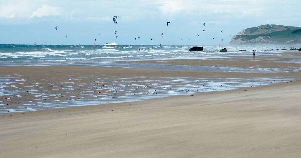
Illustration photo: Balise42 · CC BY-SA 4.0 · real photograph, cropped to 1200 × 630.

Know this spot well?
Report a mistake or add to the guide. Every suggestion is checked before it goes live.
Suggest a correction →

Weather at nearby spots

Forecast: AROME 1.3 km · SHOM/REFMAR tide · OpenWindMap anemometer

💬 Tell us what you think of this spot